Wanna know where a certain pic was taken? This article got you covered!
Here’s our list of the 7 best GPS camera apps for Android & iPhone that let you mark your pics with GPS tags. These apps let you geotag new photos and view the location info of the old ones. You’ll get to see the exact time, date, address, and even weather conditions of where the pics were taken. Some apps even let you import the tag info to navigation services, so you could easily revisit the place. Take a look!
GPS Map Camera

Let’s start with one of the leading apps to geotag photos.
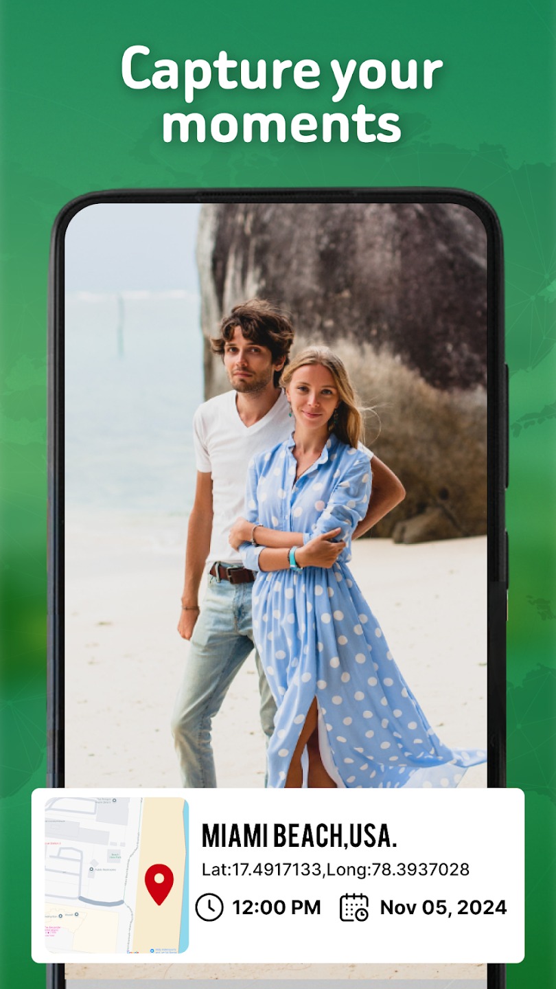
The concept of this one is beyond simple: it lets you capture your memories in detail by adding in-depth GPS info. It also comes with a built-in cam that lets you take HQ pics with geotags right away. Herewith, you may rather add map data manually or automatically, which is handy.
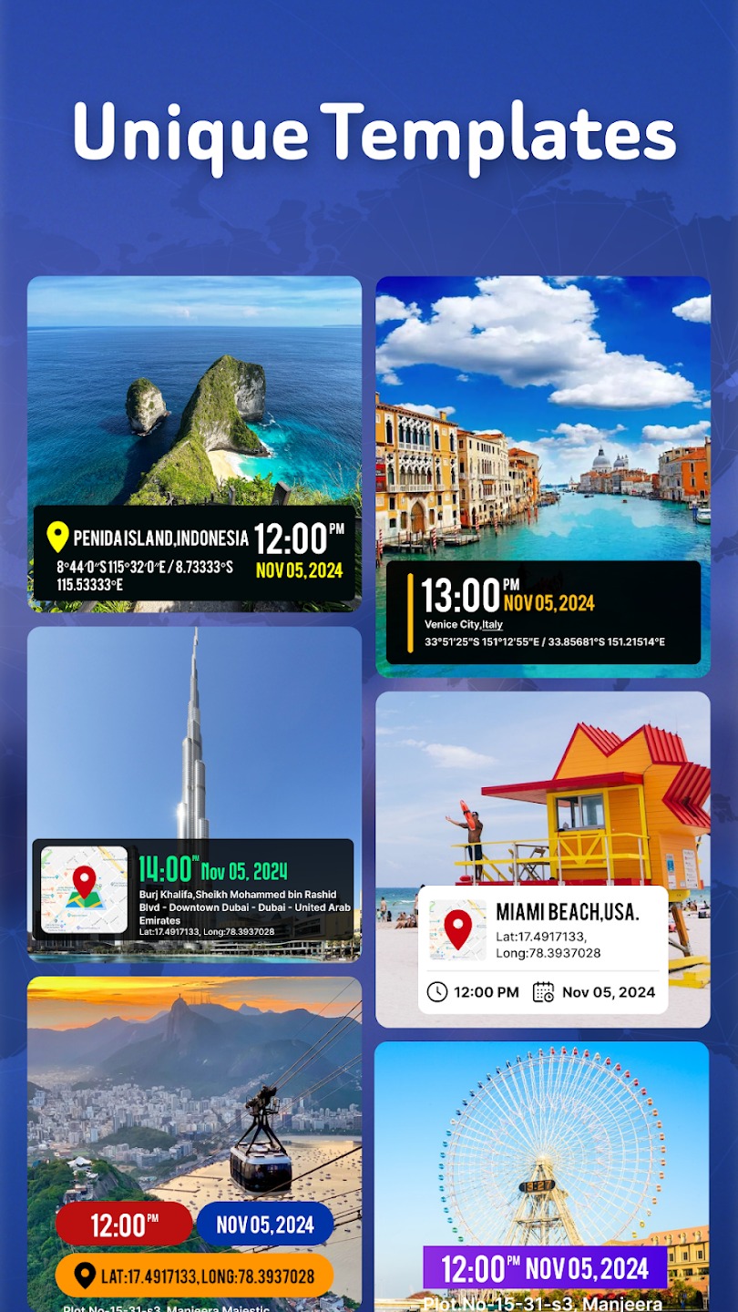
More to that, the app covers a bunch of templates that let you change the look of map info. For instance, you get to change the map type from normal to satellite, terrain, and more. You may also adjust the address, timestamps, date, and all that. You can even add a compass, wind info, humidity data, and pressure.
Plus, the app lets you add notes and hashtags for easy navigation. All in all, there are plenty of filters for you to add, so you can get the result that matches your prefs. The cam doesn’t take down the quality of the pics, and there’s no watermark, which is pleasant. Camera settings include focus, grid, flash, timer, and ratio.


You may also like: 11 Free Photo Label Apps
Geotag Photos Pro

This is a handy app that lets you mark pics with GPS info.
Apart from the previous one, this app doesn’t have a cam of its own, but it supports various formats of pics to import. However, it will automatically geotag all the pics taken by your phone’s cam by default. Thus, you can not only add pics from your phone’s gallery but also ones were taken by a pro camera.
The app supports over 15 formats in general, so you’re all the way covered. Besides, it syncs with Dropbox and other cloud services, so you can import the pics with no effort. All you need to do here is to add the pic and wait for the app to analyze it. Once it’s done, you’ll get detailed info on where and when the pic was taken.
Herewith, you can set the accuracy and logging interval as needed. You may even view a map of all the pics loaded into the app. And if you’ll ever want to revisit the places of your old pics, you can easily import the map into a navigation app of choice.


GPS Photo
This app allows you to add location data to your shots.
This app works with all the pics in your gallery and makes geotagging fast and simple. The main goal of this one is to help you find the exact map spot of your fave pics. It lets you save and share geotagged photos with just a couple of tags. The app provides you with in-depth GPS details, so you can easily revisit the place if needed.
Plus, there are plenty of stamp templates to choose from, so you could get the perfect geotag right away. There are templates for different modes and styles, so there’s smth for everyone, You can also adjust the time and date settings manually, which is pleasant. The app also covers several map types for you to try.
You may even add latitude and longitude along with weather details. Besides, the app lets you try various photos and rearrange the positions of GPS and watermarks. However, the app tends to glitch with old photos, and it works best with the most recent ones.


Pixelgarde

It’s the ultimate app for adding geotags to photos.
With this app on hand, you’ll get to add, adjust and remove GPS info from your pics instantly. In fact, the app also supports vids and pics taken by professional cams. It covers multiple formats of pics and vids, so you’re all the way covered.
Once the pic gets uploaded into the app, you’ll get to view and modify location info and other metadata with a few taps. You’ll get to change GPS info, date, time, auth, and more. In case your file doesn’t have geotags yet, the app will analyze it and provide you with an accurate tag right away.
The app also lets you take pics for automatic geotagging. It can also create a map of all the pics you upload, and you could import it to other navigation apps. In fact, you can use the app to protect your personal info by locking it on public pics and vids. The app is free, but it comes with quite a bunch of ads.


GPS Map Camera

Here’s a camera app that lets you add GPS stamps on pics.
The mechanic of this one is pretty simple: all you need to do is take a pic and the app will take care of the rest. You’ll end up with an in-depth geotag with an accurate address, date, and time the photo was taken. Besides, you can set up weather marks along with latitude and longitude info if needed.
Herewith, the app lets you set up the stamp manually by changing the location info, time, and all that. The app covers various drawing styles of maps, weather, date, and time, so you could pick the one that matches your prefs. You can also use this app to arrange your pics by changing file names.
As for the in-app camera, it’s pretty solid and covers all the basic settings you may need. It comes with grid control, flash, exposure, white balance, and even color effects. Plus, there’s a focus mode and anti-banding tool, which is nice. The cam doesn’t affect the quality of the pics and lets you shoot vids as well.


You may also like: 11 Best Panoramic Camera Apps
Timestamp Camera

As you may guess by the name, this app is here to timestamp and geotag your pics and vids.
This app lets you automatically add time and address while taking pics (or vids). The data will insert automatically by default, but you can change it manually at any time as well. You get to pick up the tags to show up, and the app supports over 80 timestamp formats. You can also change the position and size of the stamp if needed.
More to that, the app lets you change the font and its color, and there are quite a few options to try. There are also several margin modes: no, one line, half line, and the one suitable for printing. You can also add a mini-map or the compass if needed. And if you have a logo or a watermark, feel free to load it in the app and add it to your pics as well.
The app also sets you to change the resolution o pics and vids with one tap. You may even add custom text and notes and include them in the tag. The camera comes with a timer and supports a couple of fun effects as well. Thus, whatever you shoot, the stamp will match the aesthetic.


GPS Map Camera Lite

And lastly, there’s an app to add GPS stamps to your photos.
It’s a simple app that covers all the essential features. The app lets you pick and customize the time and date format. GPS stamps, and more. The tags are very details, and you can pick what metrics you would like to include However, this app doesn’t come with a variety of fonts, so the tags look quite formal and basic.
The app supports several coordinate types, from Dec Degs to UTM. You can also switch between date formats if needed. Plus, you can add longitude and latitude and rearrange the placement of stamps.
The app lets you add custom notes t other tags, and you can customize them at any time needed. As for the built-in cam, it comes with a focus mode, flash, and rotation, so all the basic needs are covered. It’s free to use if you’re okay with a bunch of ads.


GPS Photo: With Location & Map

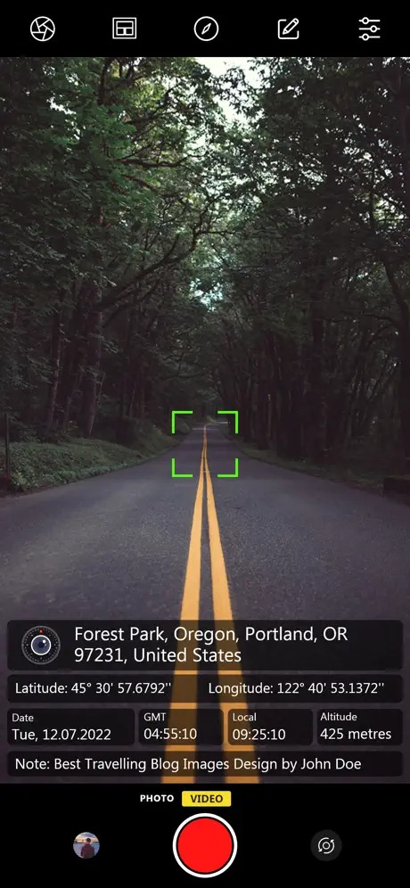
GPS Photo is a modern and convenient app for taking pictures and saving location information. It allows users to create high-quality photos and attach data about the location where they took the photo.
When you take a photo, the app automatically detects your current location and saves it along with all other metadata.
This app provides a simple interface so that everyone can take cool pictures for themselves. You can use both rear and front cameras, customize different shooting settings and take high-quality pictures. The GPS feature of the app allows you to determine your current location and save it along with the photo.
In this app, you can save a lot of useful information about the place where the photo was taken: city, exact coordinates, address, and other metadata.
The app automatically displays photos on a map using the saved location data. This helps you create interactive photo albums where you can see all the places you have visited and where you took your photos.


You may also like: 8 Best Drone Camera Apps
SpotLens

SpotLens is a handy and professional mobile app designed to create photos with added metadata. It is designed to provide users with an easy way to get accurate GPS coordinates using their smartphone camera.
The app utilizes advanced GPS technology to provide the most accurate results possible. Thanks to this, you can be sure that the coordinates obtained are correct. You will be able to take pictures even from the app itself using the front or back camera.
The app will automatically detect and display the latitude and longitude of that location or object. You can also add comments or notes to these coordinates to better describe the object or save extra details.
Here you can save the obtained coordinates in special lists or files to easily find them later or share them with other users.
The app also allows you to measure distances between different points and calculate the areas of objects based on the received coordinates. The obtained photos and their data can be uploaded to your device or shared with other users.


GPS Map Location on Camera
GPS Map Location on Camera is the ultimate app for travelers, professionals, and anyone who loves adding extra meaning to their photos. Snap pictures with real-time location, time, and compass details to preserve not just the moment but its story.
Automatically tag your photos with GPS details like latitude, longitude, altitude, and address. Add direction details to your images for precise orientation. Moreover, capture photos with a live map showing your current location. Personalize your photos with custom text for memories, work details, or special notes.
Also, you can include time and date on your pictures in various customizable formats. Choose from elegant templates to showcase location and compass data in style. Ideal for documenting travel, work reports, field surveys, or adventure photography.
Why Choose This App?
With GPS Map Location on Camera, your photos become more than just images—they tell a complete story. Whether for fun, work, or memories, this app makes capturing, sharing, and keeping track of moments effortless and meaningful.
Download now and start snapping photos with all the details that matter!
