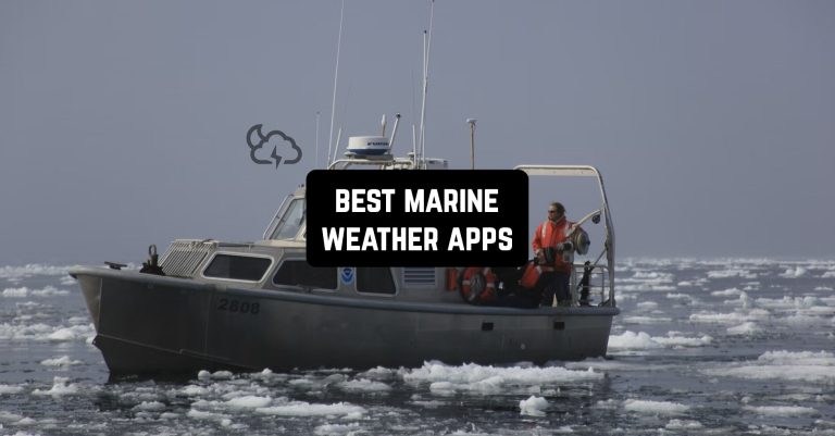
Going on a voyage to the sea, it is important to gather all the necessary things to predict your possible future. The main danger lies in the weather conditions.
If you know them in advance, you can foresee unexpected changes or cancel your trip to avoid accidents. Stay safe with these best marine weather apps for Android & iOS.
Plan your route and track the vessels in real-time on interactive maps with these best marine traffic apps.
PredictWind

The PredictWind app determines the sea weather forecast for a comfortable stay. It will provide safety, and save time. The data source is reliable and accurate, especially within a radius of one kilometer.
The following indicators are available on the map: wind gust, wave amplitude, rain intensity, cloud cover, air and water temperature, and atmospheric pressure. Extra tools are available.
The app is capable of laying the optimal route, taking into account the initial and final coordinates, the model of the vehicle, currents, and wind speed. Thus, it is possible to successfully select the starting date of the trip.
Massive weather information is given in the form of concise text. Maps are of high quality, and underwater lines, spikes, arrows, and other designations are movable. Some data is presented in the form of a table.
It is possible to work with several forecasts at the same time. There is a function of online observation through the camera. Information about destination events, and its characteristic is available.


When the specified weather conditions are reached, the app will notify you. A personalized page is created at no extra cost.


You may also like: 7 Best Vessel Finder Apps for Android & iOS
Marine Weather | SailGrib

This app is for getting acquainted with weather forecasts for water bodies and water sports. Also useful for sailboat and cruiser drivers because it notifies them of tides.
The app will ensure comfortable rest and safe sport without unexpected surprises.
All weather forecasts from different sources can now be compared in one app. All resources are as accurate and reliable as possible.
The high-quality map is easily scaled to select a region. Any parameters such as atmospheric pressure and wind speed are automatically detected. Offshore use with a satellite phone is possible.
The map works offline, without the Internet. The following indicators are available in the app: wind speed and direction, atmospheric pressure, precipitation probability, air and water temperature, wave amplitude, and tidal range.


You can get the result to your e-mail address. The size of the downloaded file is adjustable for convenience. Keep in mind that all forecasts are only indicative, they only tell you how the weather will change after a certain period of time.

BoatUS

An app that can be used to call for a watercraft tug. Already hundreds of thousands of boaters do not agree to go to sea without BoatUS.
An organized network of overwater towers with hundreds of personal ports provides the basis of operation. To get urgent help at any time of the day, you need to press the appropriate button. It will send the call to the control room.
Location is automatically determined by GPS. A crew will leave for the received address.
The function of tracking such indicators as tides, and weather forecasts for a particular route or route is also available. The maximum sampling is five days. You can add your preferred locations to a favorite folder.
The app has a preventive orientation. Before going out on the water, it is useful to inform and update the data to avoid accidents. For example, users are notified of an impending hurricane in a certain area.


There is a monitor of good deals from local stores. They do discounts just for BoatUS users. A great way to save on supplies and life jackets. BoatUS has data on insurance prices offered by water sports experts. Through the app, you can share geolocation on social media and messengers.


NOAA Weather & Tides

NOAA will provide correct water weather forecasts and tidal times. Readings are scheduled for the next seven days for locations around the world. Works based on the user’s present location or any other point on the map.
This is a great tool for planning safe travel and sporting events. The uniqueness of the forecasts is that they are calculated for each square mile separately, taking into account all the factors affecting weather conditions in a particular location.
This is indispensable in locations with volatile and unpredictable weather. You can save your favorite and frequently visited locations in a favorite folder and return to them again if necessary.
Weather information is updated every hour. Arrows, cyclones, and precipitation are movable on maps for better perception. If the weather threatens users’ safety, the app warns and advises them not to go out on the water. Tides are displayed in the form of charts.


You can install a widget on your phone’s home screen for quick access to the app. Light and dark interface themes are available. To get rid of ads, you need to buy a premium version.


NOAA Buoys Live Marine Weather

The app allows you to find out all the details about the weather outside the water in real time. It is a receiver for all the data provided by the NOAA.
If any indicator is missing, it is a lack of source information, not an error in the app. It successfully helps plan water sports, fishing, surfing, and just family vacations.
The app will provide a person on the water with safety and complete peace of mind. Resources are accurate and reliable at the highest possible level. Information is provided by the current location according to GPS or any point on the map.
Favorite places can be saved in a special folder and returned to them again. There is an offline mode, without using the Internet.
The following indexes are available: water weather forecast, sunrise and sunset times, wind direction and speed, wave amplitude, air and water temperature, atmospheric pressure, and dew point. They are constantly updated.


The app is clear to use. The user-friendly interface and high-quality color scheme leave no questions.


WindHub

WindHub is an app that provides users with an accurate weather forecast on the water. It is indispensable for water sports, outdoor activities, surfing, yachting, fishing, and recreation.
It is an essential planning tool used by beginners and experienced sailors alike. It will show which areas are dangerous to live in due to adverse environmental conditions.
WindHub provides weather forecasts from several servers. It rates the data adequacy and correlation to reality and calculates the most probable result.
The resource is as accurate and reliable as possible. The following indicators are available on the map: wind gusts, wave amplitude, rain intensity, cloud cover, air and water temperature, and atmospheric pressure.


The map is of high quality and is easy to navigate with a few taps. You can know the forecast for a certain area as well.


You may also like: 11 Best Offline Navigation Apps for Android & iOS
PredictWind Offshore Weather

Marine Weather is an app that allows you to determine the weather forecast on the water and coastal areas. Users can independently select and download files with certain locations and routes, which are accompanied by satellite images.
There is access to the most accurate and reliable forecast servers. High resolution is provided within a radius of one kilometer.
There are extra tools that save a lot of money and time. They will allow you to protect yourself on the open water and reduce the threat to life to a minimum.
The app is able to calculate a route with optimal environmental conditions with high resolution. You can get the result back as a file. It is so lightweight that it is supported even by a satellite phone with low bandwidth.
The app also works via Wi-Fi and mobile networks. All lines, arrows, and spikes on the maps are movable. Some data is presented in the form of a table for convenience. Graphs allow you to compare several indicators at once.


The forecast is available for viewing both on the map and as a text document. It is not difficult to find out about the state of the weather at your destination or at a certain point on the map. The creation of a personalized page is free of charge.


Météo Marine

Météo Marine is an app containing a water weather forecast. It is developed by professional meteorologists, sailors, and marine nature specialists for sea lovers.
The program is indispensable for sailors, fishermen, skippers, and divers. All the information you need is in one app. There are real-time forecasts as well as bi-weekly predictions.
In addition to weather conditions, ports, beaches, bays, and the best places to dive and fish are listed. To choose the most reliable source of information, there is an opportunity to compare several.
If the weather conditions are unfavorable, you can find a new route with satisfying environmental indicators. Favorite places and routes are easy to save and share with friends and family. View tidal intensity is available.


All precipitation, hurricanes, and storms on the maps are moving. Every hour the data is updated and only a touch away from accessing it. To stay up to date on changes, there are customizable notifications.


High Seas Marine Weather

An app that has over five hundred sites on the water with weather descriptions. Priority is given to the Pacific and Atlantic Oceans and the Mediterranean.
The following indicators are available: water weather forecast, sunrise and sunset times, wind direction and speed, wave amplitude, air and water temperature, atmospheric pressure, and dew point. They are constantly updated.
The app also analyzes the condition of the water’s surface and the degree of danger of a natural cataclysm. All forecasts are based on official documents and are reliable.
It is possible to use the documents offline outside the Internet. This is made for long-distance sailing enthusiasts. Updates are received two to four times a day. No action is required of the users at all, all data is updated independently.
The privacy policy is transparent. Only the name and version of the operating system of the phone, its brand, and the age of the app installation can be transmitted. Personal data is not transferred to third parties, as the service has no access to it.


The creators have nothing to do with the advertising placed in the app, but try to adjust its content.

Windy.app

WINDY is an app that will show an accurate weather forecast and wind direction for any point on the map. The information covers the week, divided into days and hours. It is easy to know the weather at both near and far distances.
You can place the widget on your phone’s home screen for convenience. Wind readings are available for ten days and divided by three hours.
It is possible to view a ten-day weather archive: wind speed, night and day temperature, and atmospheric pressure. This will help you choose the most favorable month for your vacation.
The app is most useful for fans of yachts and boats. There are the following indicators: wind speed, its direction, precipitation, the temperature in the air and on the water, wave amplitude, tides, sunrises, and sunsets.


The database contains more than thirty thousand locations, the favorite can be saved in a favorite folder. You can watch the weather online from weather stations or offline without access to the Internet. You can discuss nature with other participants in the chat room.


You may also like: 7 Best Fish Identification Apps for Android & iOS
Buoyweather

Buoyweather is an app that provides users with weather forecasts for bodies of water in a certain area. It will make spending time on the water a joyful and safe experience.
The tool is suitable for planning a vacation at sea. The accuracy is two days or a week. Selected locations can be saved for quick access.
The resource is accurate and reliable and compares readings from several databases. The following indicators are available on the map: wind gusts, wave amplitude, rain intensity, clouds course, air and water temperatures, and atmospheric pressure.
The competent and concise interface of the app will direct your attention to the main indicators. The map is of high image quality, easily shifted with a few taps.


The free version has access to a two-day weather forecast. It will not last more than a week. To continue using the app, you need to buy the full version.


