Guys, we’ve published many applications for outdoor activities, and reviews to them. There you can find all useful information about this app, its design, features and even a real editor’s first experience.
Speaking about activities, we have to notice about Geocaching Apps for iPhone & Android and their reviews. There you will learn what is geocaching and why you should get it.
Remember these days in childhood when we dreamed about long challenging adventures ,exploring mysterious forests, travels to different distant corners of the world, hiking mountains, broadening new horizons ? We thought, that someday all our dreams would become true.
What is distract us from biking, exploring and hiking far far away from home now? Exactly- nothing! Nowadays, it is all about technologies and gadgets. Today, for planning the best trip ever , it is necessary to download some applications – companions. One of these helpers is a multifunctional outdoor navigation app : Locus Map for Android.
We decided to write a full review to this application as one of the most efficient and standing out among the others. By the way the version is free and available to download on [wpsm_button color=”orange” size=”medium” link=”https://play.google.com/store/apps/details?id=menion.android.locus” icon=”check-circle” class=”” target=”_blank”]Google Play Store[/wpsm_button]
Design and Layout
First steps of usage seem to be very difficult: too many buttons, categories and you don’t exactly know where is a necessary map, or tracker. Don’t be afraid, a few minutes later you will forget about this problem. Well, firstly, you will see this home page:
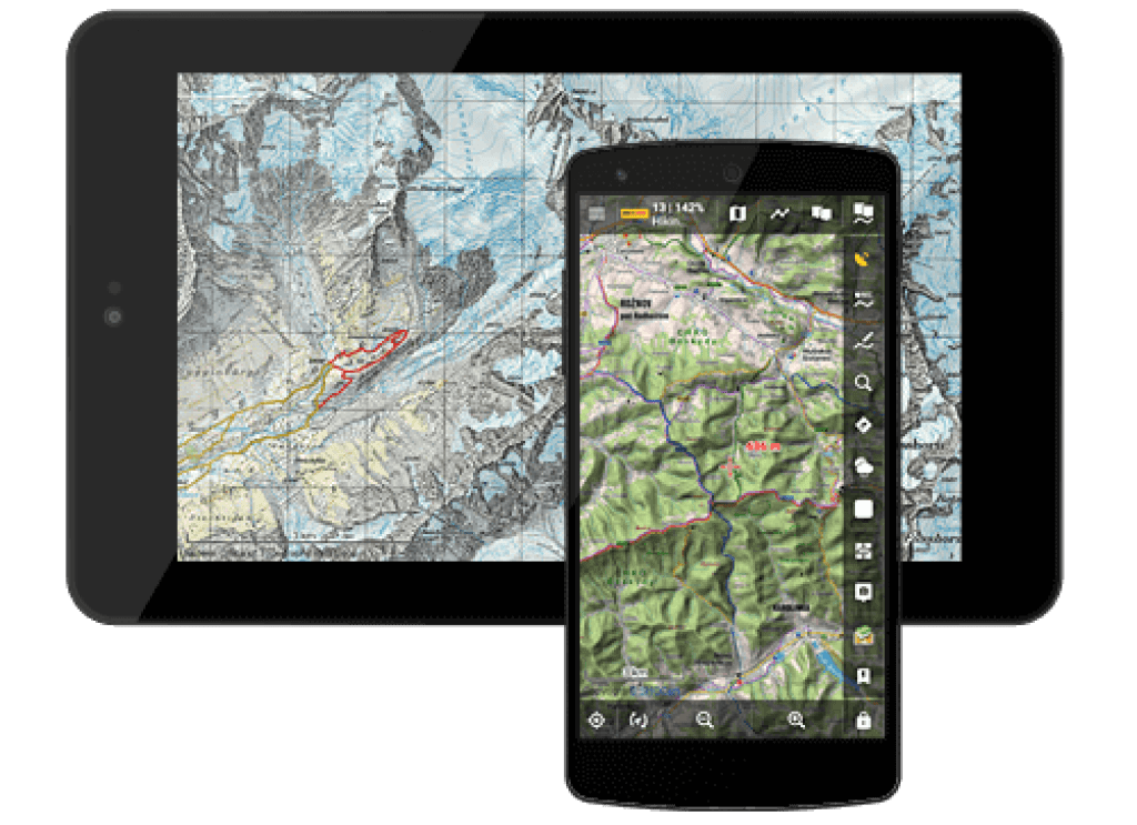
Apart from the world’s maps, Locus’ portfolio gets an access to hiking and cycling maps, small town plans or maps of big cities with their numerous avenues and districts. GPS function immediately determines where are you now. Now let’s talk about the main screen.
- Main menu
Tapping on the main menu in the left top corner of the screen, you fill face settings and functions of the app. Also, there you can find an entrance to the Locus Store - Information field
It depicts your version – Locus Map Free or Locus Map Pro and gets you various options to display : Map, GPS, Coordinates, Guiding, Track record , Time, battery, Sunrise/Sunset. I think, there will be no difficulties. - Search
All online addresses powered by Google. Searching was never as simple as now. - GPS Indicator
As for GPS indicator, there are some icons, indicating your internal status :

- Tapping this button, the menu appears for a fast switch off GPS status.
- A cursor of the center of the map screen
- your GPS position
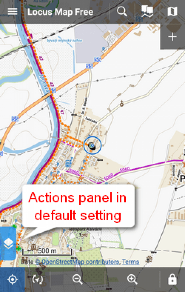
- Action panel
Сontrol over the map is very simple, using tap gestures:
touch and drag – map shift
double tap and drag – map
zoom pinch – map zoom - The bottom panel
- Rotation
By default offers two methods of viewing your actual position in accordance with your built-in compass. Either it is rotation of the map as a whole or displaying your eye view
- Zooms in/out
Locus map offers various ranges of zoom in, depending on what do you want to see. Basically, The button – zooms out is for switches to a smaller map scale, the+ button zooms in is for switches to a larger scale.zoom 8 – major cities, highways and main roadszoom 9 – towns and secondary roadszoom 10 – 13 – villages, tertiary roadszoom 14 – 15 – streets
zoom 16 – 17 – houseszoom 18 and above – house numbers (some maps) - Lock
There are screens of the main menu:
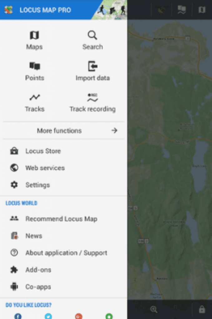
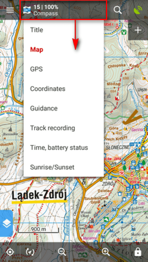

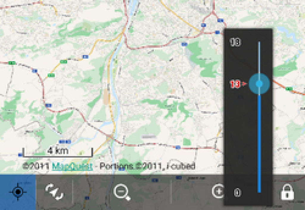
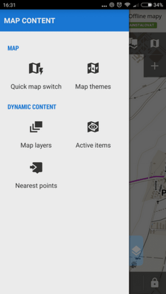
More attention I want to pay for Left Action Pannel:
Sliding the left side of the screen, you will be shown several switches and additional map content.
![]() Quick map switch
Quick map switch
Gets you all information about latest opened maps and nearest offline maps you’ve downloaded.
![]() Map themes
Map themes
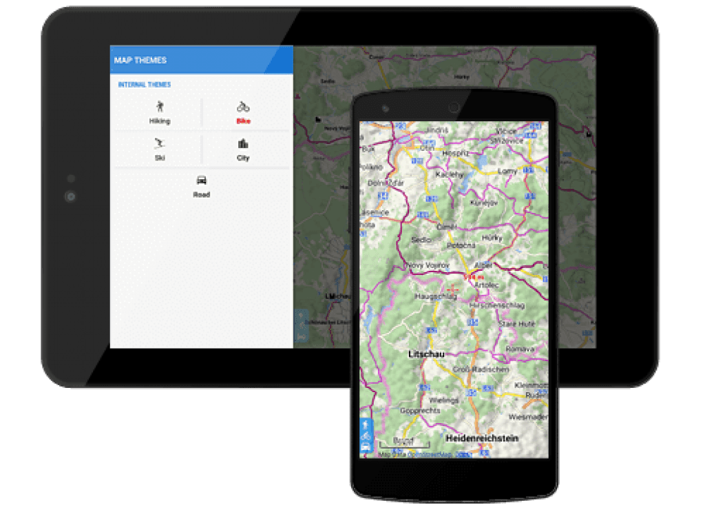
Is available if you use some vector map containing switchable map themes.
![]() Map layers
Map layers
This section provides you an access to additional map layers which you can see tapping on the button.
![]() Active items
Active items
List of all active KMZ/KML files from the Items tab of the ![]() Data manager. Tapping the file unfolds included layers that can be switched on/off and their opacity adjusted.
Data manager. Tapping the file unfolds included layers that can be switched on/off and their opacity adjusted.
![]() Nearest points
Nearest points
A list of points from Locus database that are nearest to your actual position, no matter if they are active or not. You are given four categories to choose.
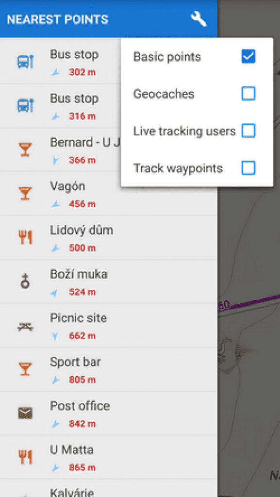
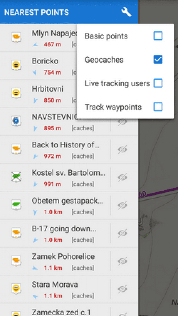
Geocaches – geocaches you’ve downloaded
Live tracking users – users that are nearest and who have Live tracking feature active – for all or from your private live tracking room
Track waypoints – nearest waypoints that are part of your track database.
Features and how it works
First of all, it is, of course, navigational application for those people who appreciate an active way of life and prefer to go out to sitting at home. For such people, Locus’ developers have created a navigational app if you are going to hiking, biking in a strange highland, looking for geocaches in mysterious forests or visiting cities you had never been before.
It doesn’t matter, whether you are going to biking or hiking or searching for a way to a pub or a place of a meeting.
As for features, you are able to import your own tracks and points of interest and create your own way to favorite destinations or just trust to the navigator. Locus Map will be the best handy assistant in everyday and outdoor activities.
Some useful steps that will help you to appear in a right place for few minutes.
First of all, you should download necessary maps. How can you do it :
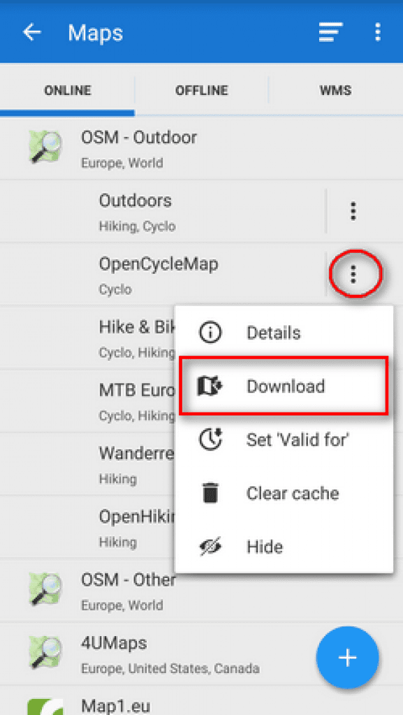
Go to the Action panel and tap on ![]() Download against an online map you want to choose. After that, follow the steps below.
Download against an online map you want to choose. After that, follow the steps below.
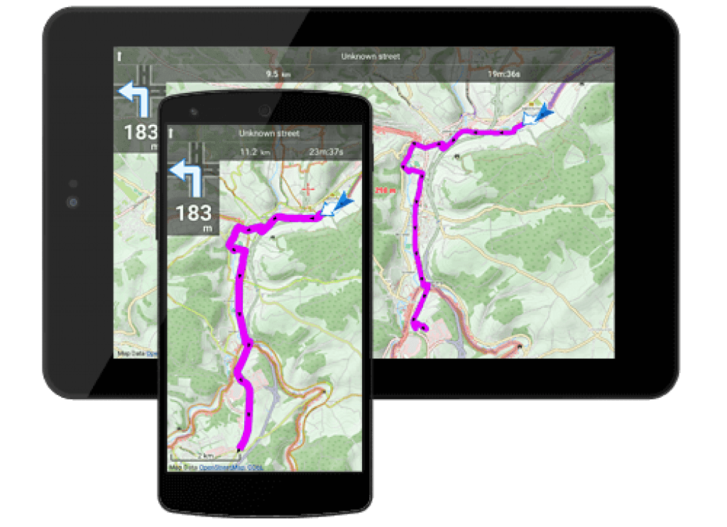
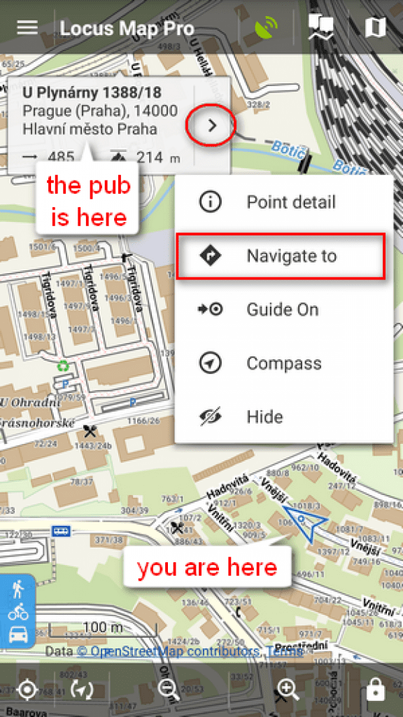 Step 1 : Tap long on the place you want to go and its address will immediately appear. After that click the ” >” and select Navigate to.
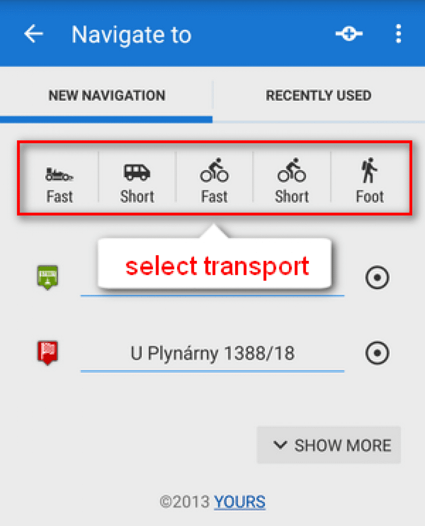
Step 2: Choose the transport you will use to go to the place from mentioned below.

To my mind, it is very convenient and useful when you see your route, every turns , distance to target and time you will spend while driving. Apart from, with navigation, you will never lose in a strange city. You can use navigation not only for cities but for outdoor activities too.
2. Offline Maps
Of course, developers understand that there is some place , where internet connection loss. Just imagine, that you are going to broaden mountains’ heights relying only on online maps. It is madness! Locus Map offers to download of offline maps of the whole World from Locus Store and also allows you to save some of the online maps to your device. Maybe someday offline maps will save your life, actually.
How to use Offline Maps

Before using, you need to download them:
go to Offline tab of the Map manager and tap ![]() button
button
If you don’t have maps on your personal computer or device memory click ![]() Offline maps download and choose maps that Locus Maps Store offers.
Offline maps download and choose maps that Locus Maps Store offers.
tap on ![]() External maps and add maps from your memory card.
External maps and add maps from your memory card.
That’s all!
But after that, you will be able to use all offline maps supported by all functionalities without any limits.
It is the second main feature.
3. Geocaching
In childhood, we used to hide something in unexpected place, but with a lot of exciting prompts and hints, and then you or your friend were looking for it and finally found. We could search that thing all day long and it didn’t annoy us. So geocaching is the same game but for adults.
It is an outdoor treasure hunt that utilizes a GPS or GPS- enabled mobile device and GPS coordinates to find hidden treasures called geocaches.
Saved geocaches contain full listing, images and also logs of your friends
How to use Geocaching
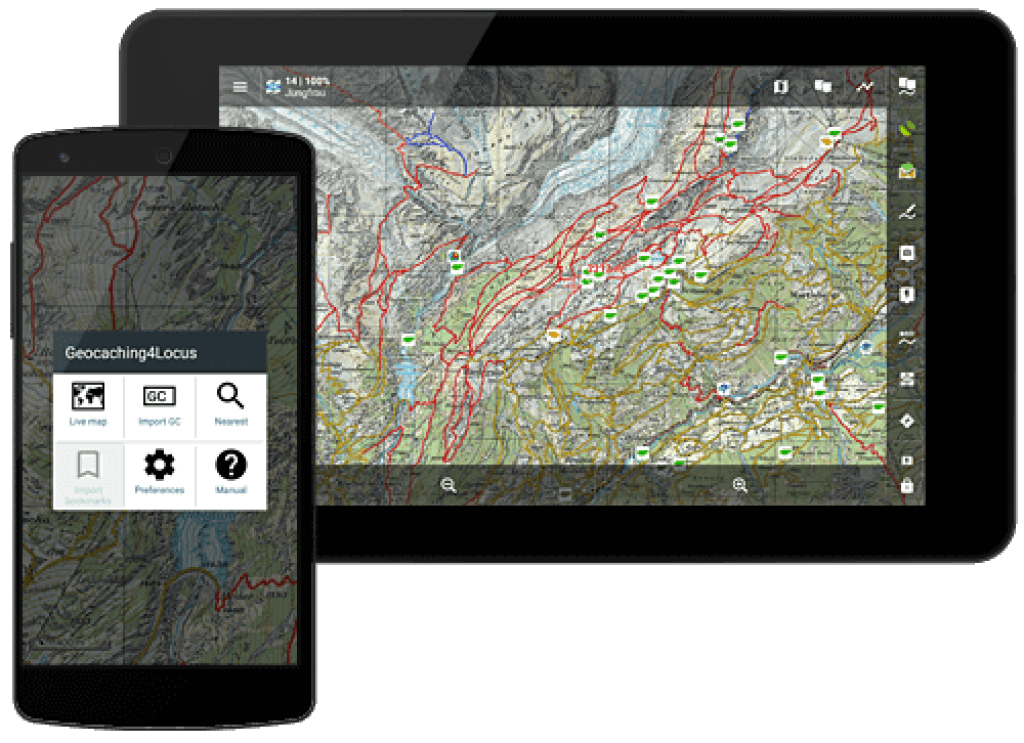
The easiest way is via the Geocaching4Locus addon which you can get on Google Play Store.
Then, follow the next steps in order:
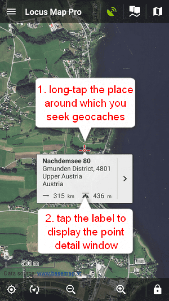
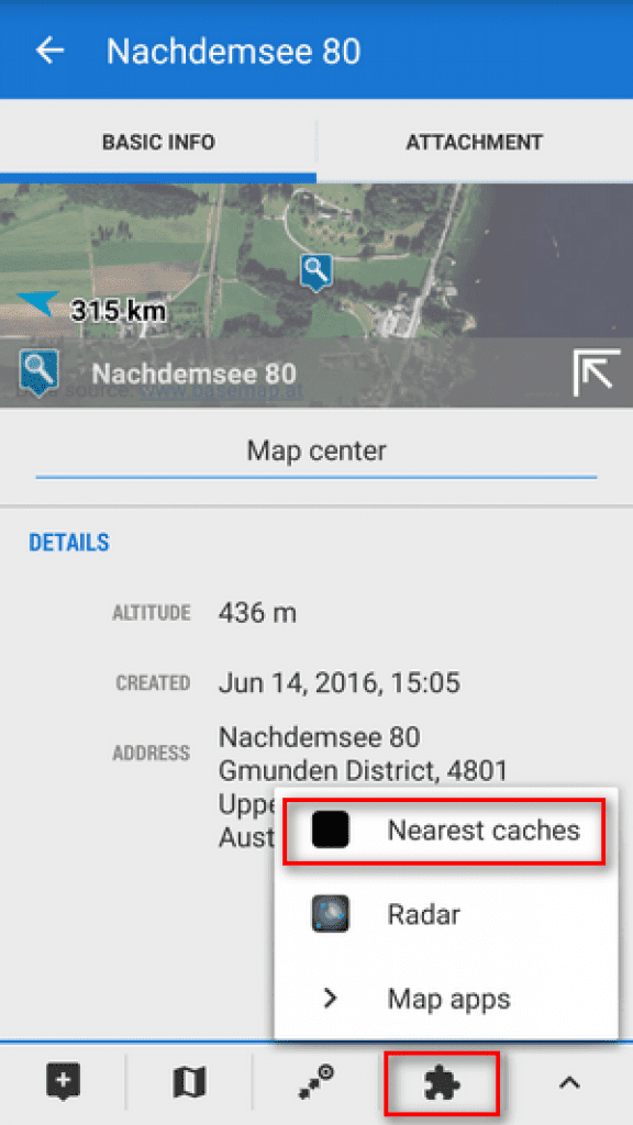
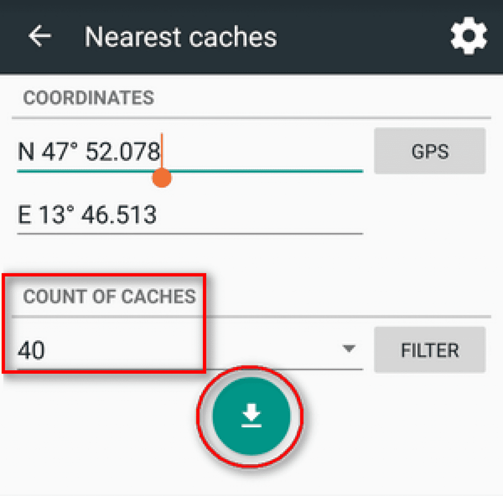

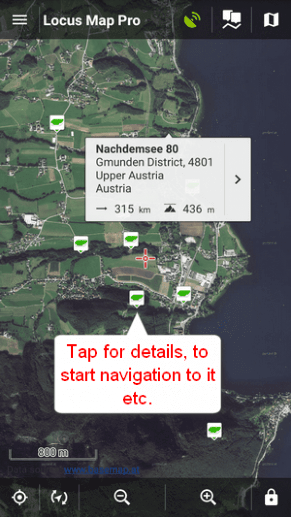
I think, that comments are unnecessary. Geocaching is my favorite option in this app. It is such a pleasant addition to your activity, I mean you can combine your hobby with searching for geocaches together with your friends and family.
 4. Track Recording
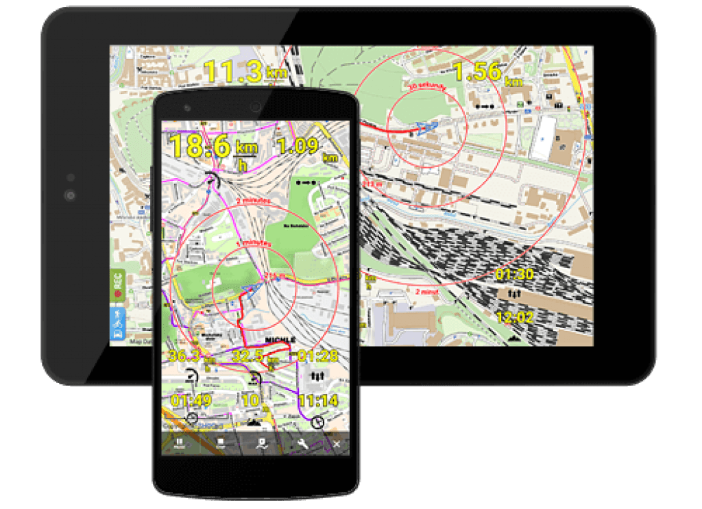
As for this feature, it is perfect for bike and walks lovers. Every time you go out, you can track all your trips, measuring distance,total time and speed. Moreover,there is a data on elevation and elevation profile
To my mind,the tracker is the best way to measure a progress, every time you can see how long did you climb a mountain, or how fast you challenge a distance on a bike.
Each track can be completed with your own points, photos, videos and sound recordings.
How to track a trip
Make sure that GPS is on – The GPS icon ![]() must be green
must be green
Step 1: slide the menu and tap on Track recording
Step 2: choose the way of your activity in the bar Recording Profile – bike ,hike, car and so on and tap on the green button Play. Locus Map will immediately start recording your trip
Step 3: Make the tracking yours: tap on pause or click stop in every moment
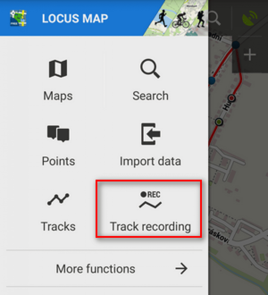
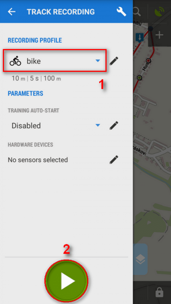
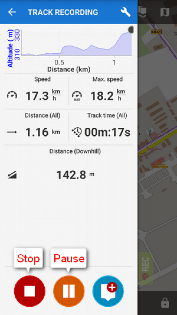
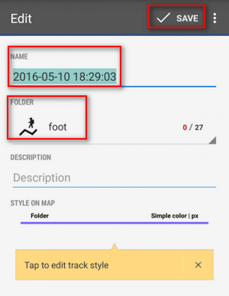
After your training or trip, name your track or just leave it named by the date stamp. Select folder to store into and tap Save. Your trip is saved and you can boast about it to your friends.
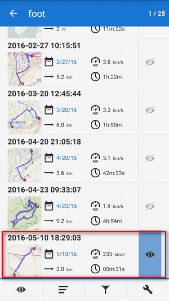
All track will be saved in Track tab ( Menu> Track tab). There you also can find a history of all your trips and adventures supported with a date, length, full time, and speed.

Well, that’s all! The FreeAppsForMe team has explored the app ” Locus Map” for Andriod backward and forward. We haven’t found some weaknesses, that’s why we recommend you to download Locus Map as one of the best multifunctional outdoor navigation apps.
