A drone is a relatively unusual instrument that helps its users to see different places on our planet from a bird’s eye view. In order to do this safely and always know where your drone is, you need to install a special app for tracking the location of the drone.
Moreover, the footage made with a drone is not always a good quality video. There is a solution – just use a video quality enhancing app.
Thus, we have found these apps and collected the best drone detection apps for you in the article down below.
Dronecast
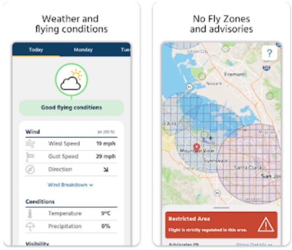
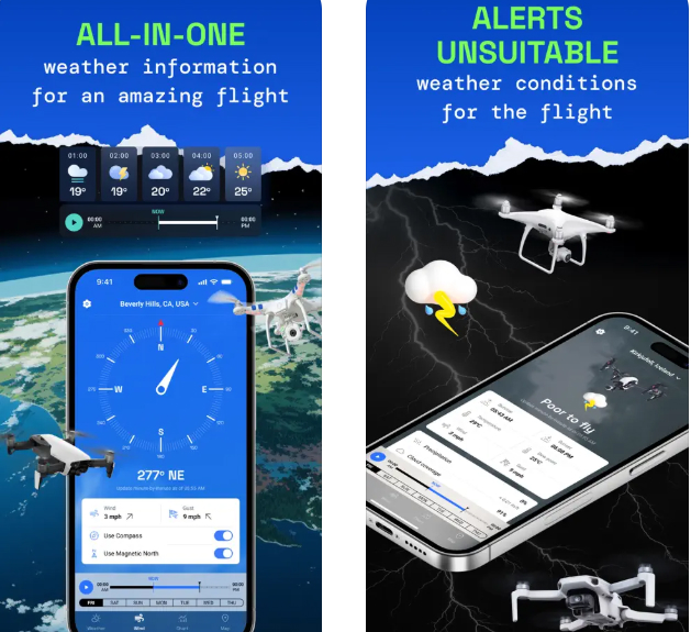
During any drone launch and flight, it is essential to make sure that the device is safe and take into account all possible factors that may affect the flight. This is exactly what the Dronecast app will do. In this app, users can check the weather forecast and make sure that nothing interferes with the flight.
Here you can also see what the wind speed is and whether the drone can withstand these gusts. In addition, the app indicates the zones in which you cannot fly. This app is suitable for different drone models such as:
- DJI
- Parrot
- Ryze and many more.
What is also really convenient for users is that the app has absolutely no ads. Here, users can easily track the location of their drone and take into account many factors during the flight. According to user feedback, they found this app simple, straightforward, and really user-friendly.

You may also like: 11 Best Skiing Apps (Trackers & Weather Control)
Dronelink
Thanks to the Dronelink app, users can pre-create and plan routes that their drone will then fly. This app can be used on multiple devices at once, such as:
- Web
- iOS
- Android
- DJI monitors, and more.
The mission planner in this app creates 3D models of the path along which the drone will fly before the flight itself. This way users will know what to expect from the flight and the terrain. Users can automate any setting during flight, not just the flight path itself.
According to user feedback, the idea of the app is really good, but the implementation is still weak. Due to the fact that the app does not work at full screen, visibility in flight is significantly reduced.


Drone Scanner
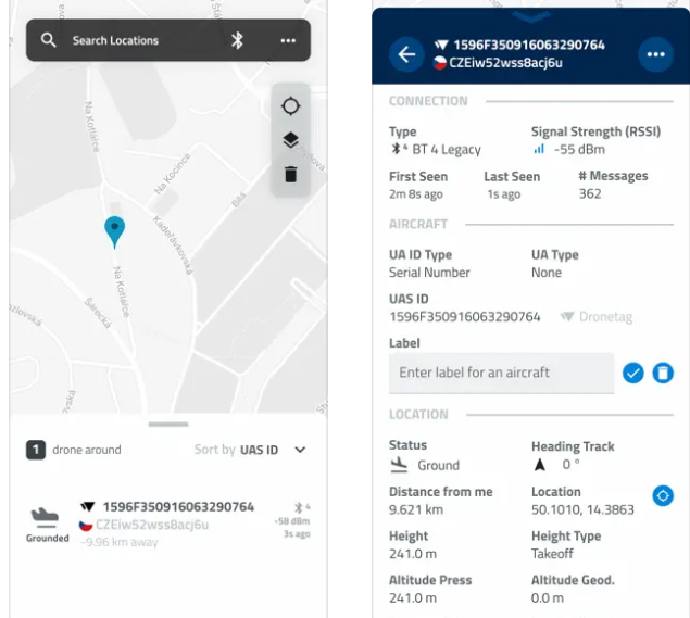
Curious about what drones are flying around you? The Drone Scanner app, by Dronetag, turns your phone into a drone detector! It picks up signals from nearby drones broadcasting their location and flight information via Remote ID. You’ll see these drones on a map, along with details like their altitude, direction, and even the pilot’s location.
It’s important to know that the app’s functionality can be limited by your phone’s hardware. For example, iPhones don’t allow apps to access Wi-Fi for this purpose, so you’ll only see drones broadcasting via Bluetooth. This isn’t the app’s fault, but a limitation set by Apple.
If your phone supports it, Drone Scanner is a fascinating way to learn more about drone activity in your area. It’s a great tool for anyone interested in drones, from hobbyists to professionals concerned about airspace safety.
So, download Drone Scanner and start exploring the skies!


You may also like: 5 Best Video Splitting Apps for Android
Drone UAV Fly Forecast: AirMap
Planning a drone flight? The Drone UAV Fly Forecast: AirMap app is your essential companion for safe and informed flying.
This app provides crucial weather information like wind speed, temperature, and even the KP index, which is important for stable drone camera footage. Knowing these details helps you choose the perfect conditions for your flight.
Even better, the app clearly shows no-fly zones and air traffic control areas, keeping you on the right side of regulations. Real-time alerts notify you of any sudden weather changes that could impact your flight, so you can stay safe and avoid any surprises.
Whether you’re a pro or just starting out, the Drone UAV Fly Forecast app is a must-have for planning efficient and worry-free drone flights.


Airhub
Airhub is an app that manages to combine all the necessary features for tracking and safely using your drone. This app will help those who often use their drone. In this app, you can track the factors affecting the flight before the flight itself.
In addition, you can carry out certain actions right during the flight. You can also track statistics and parameters after the flight. The app supports both individual flights and group flights.
In this app, users will be able to familiarize themselves with the important rules that must be followed during the launch and flight of the drone. The local weather forecast and wind speed are also available here.
More importantly, here you can track the battery charge of the drone. In order to be fully aware of the status of the drone during the flight, this app can track the flight time and the location of other aircraft. After the end of the flight, users can see the statistics.


Dronar
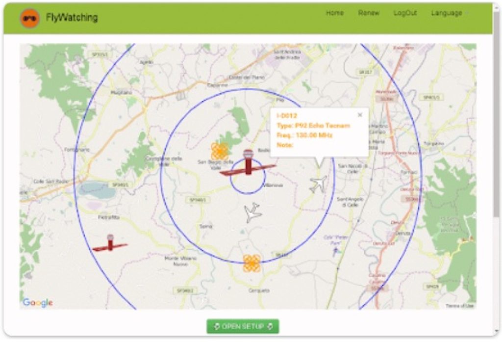
This app, in its functionality and purpose, is quite similar to the classic radar. Here, users can track the location of not only their own drone but also other drones, as well as various aircraft.
The Dronar app helps its users turn a mobile phone into a radar to track the location of objects in the air. During the flight, users can adjust various flight parameters such as:
- ground speed
- heading
- altitude.
Users can turn on WiFi or Bluetooth on their drones and track flight data. In addition, this app can be used as an air navigator. Also with this app, users can track data about other objects in the air. Based on user feedback, the interface and visuals of this app need to be improved and are not yet really handy for use.

You may also like: 15 Best time lapse apps for Android & iOS
Aerial Armor
Since 2015, this app has been helping its users clearly track the location of their own and other drones on the map. With this app, you can track the safety of the flight. The map in the app is made in detail.
Via this app and its map, you can track and plan a route for the drone. Also in this app, you can view information about other drones. Information such as:
- drone type
- drone number
- time
- altitude and more are available here.
Thanks to the settings, users can customize the app for themselves. The app will help you evaluate possible obstacles to the flight, as well as show whether all the necessary conditions for the flight are met. These are such conditions as:
- electricity
- internet, and more.
Also, the app will send a notification to users if there is an obstacle or another drone nearby.


